Departure of the circuit "The Mont Canisy, the Parc Calouste Gulbenkian in Bénerville-sur-mer"
Description
1. Starting from Blonville-sur-mer Tourisme, turn right onto Boulevard Marcel Lechanteur till you get to the beach. Turn left and walk along the beach till you get to the sailing school.
3. Turn left onto Rue de la Brèche aux Cochons.
4. Turn right onto Avenue Michel d’Ornano till you get to the campsite.
5. After the campsite, take the pathway on the left. You’ll reach the marshes.
The marshes of Blonville-Villers are the only natural green area of the Côte Fleurie. This place of great ecologic richness includes 110 hectares of wet grasslands, canals and ditches. Though being close to the sea, it is a fresh water marsh fed by the water courses coming from the surrounding hillsides.
6. At the crossing, turn right and continue straight. The canal (stream) is on your right.
7. Leave the path on the right, and slight left. The path, following a wooden fence, becomes narrower.
8. Leave the path on the left, and slight right.
9. Leave the path on the right and continue to Chemin des Rangs.
10. You are leaving the marshes. Turn left and walk for a few meters on Chemin du lieu Chesnay, then take the first path on the right: Chemin du Lieu Pieugé.. It goes up, then under the railway. You reach the D20 – Route de Tourgéville.
11. Cross it and continue to Chemin du Droulet (leave the chemin du Chanteur on the left) till you get to D118a – Route de Beaumont.
12. Turn right onto D118a – Route de Beaumont and reach the Notre-Dame de la Visitation church of Blonville Terre.
The Blonville Terre church has a one-thousand-year-long history! Actually, part of the bell tower dates back to the 12th century. The most ancient elements are the lowest parts of the bell tower and of the choir, dating back to the 11th and the 13th centuries. A large nave was added at the end of the 15th century.
13. Leave the church and its cemetery through the main door. Turn left, then take Chemin du Quiévru on the left till you get to Chemin de la Butte Montor.
14. Turn left onto Chemin de la Butte Montor till you get to D20 – Route de Tourgéville.
15. Turn left onto D20 – Route de Tourgéville (leave the Chemin du Pré le Houx on the right) till you get to the Chemin des Enclos crossing. You are now in Bénerville-sur-mer.
16. Turn left onto Chemin des Enclos. Going up, you’ll find the Parc Calouste Gulbenkian on the right and a great panorama on the left.
The Parc des Enclos Calouste Gulbenkian, open from May to half October, hosts rare plants and joins different atmospheres favouring meditation, as its creator wanted.
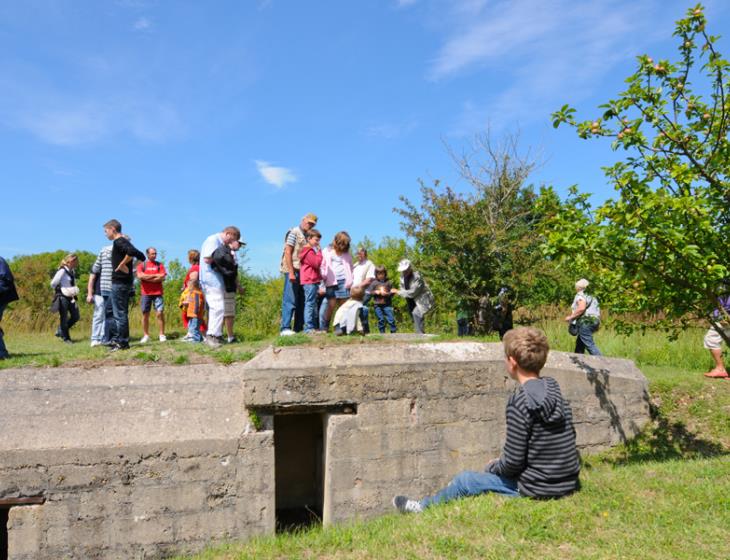
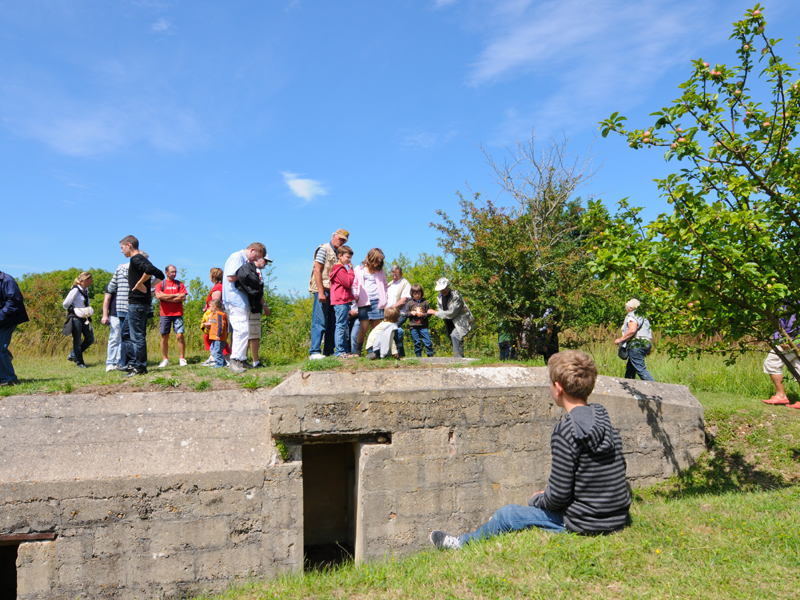
17. Turn right onto Chemin de Fontaine Marie. It leads to Mont-Canisy. There, follow the GR red and white signs. At the crossing, turn left. Follow the chalky stone path till you get to the platform. Here, you’ll find a grass area, the entrance of a bunker, green barriers and a flag.
The Mont-Canisy offers an extraordinary view on the Côte Fleurie. The Mont-Canisy has been a seigniorial domain for centuries, and is today a natural site protected by the Conservatoire du littoral, which preserves its flora and fauna. It is also a place charged of history: casemates, bunkers.
18. Leave the Mont-Canisy and the GR sings and take the path going down to the right . At the crossing, turn left and continue to the Town Hall of Bénerville-sur-mer. In front of you, you’ll find the small Saint Christophe church.
The Saint-Christophe Romanesque church of Bénerville-sur-mer dates back to the 12th century and its bell to 1596. Situated in front of the sea, on the edge of the slope, it overlooks the extraordinary Baie de Seine.
19. At the roundabout, continue to Rue du Ricoquet, cross the Avenue du Littoral and continue to Rue Hoinville till you get to a roundabout.
20. Turn right onto Avenue Michel d’Ornano till you get to Blonville-sur-mer Tourisme.
Prices
Services
Opening
Labels & order